Nick had posted the idea of a TB run on the 29th. He had been previously mentioning an intriguing war memorial for an Australian airman who died when his plane crashed during WW2 in the Lammermuirs. After a bit of googling and map drawing I realised the wm was not far from a circuit of the Lammermuirs Mary and I used to do. And if we started and finished in Gifford it would be around 30~31miles. I drew a map using Suunto software and uploaded it into my watch so we would be able to follow the sat-nav once we got near the crash site as it is quite remote and off the trail.
It was snowing fairly steadily as we set off - I have never taken so few pics along Hopes Reservoir which is almost always very scenic. There was lots of chat and banter but the snow was bouncing off our eyes and making the going quite harsh, especially on the higher ground. When the wind was to the side or back it wasn't so bad, but it seemed to be in our faces for the majority of the first 10 miles.
We passed Carfraemill at around 13miles and decided to have a coffee and dry our gloves on their aga. We were pretty much the only customers. The coffee was good and fortifying. We had been covering the ground quite quickly and the next handful of miles went equally fast. The section along the A697 is always a bit unnerving but soon we turned off and up the quieter road to Longcroft Farm.
I thought my camera had died here. Impossible to keep all the snow flakes off the zoom lens and once it gets wet it plays up. It stopped any kind of focussing and I had to dry it a bit and switch it on and off. (The new camera was safe and dry at home.)
frozen pond
Longcroft Farm
first river crossing
The rivers were quite low considering the amount of rain and snow falling. We skirted round both crossings and using stepping stones managed to keep feet "pretend dry". The paths were still visible enough to follow but every now and then you'd hit a frozen puddle and do a one legged slide for a heart stopping yard or 2 and be flushed through with adrenaline.
Glenburnie
2nd crossing
Bunny's Bothy
Now the last few times Mary and I have run this circuit (the 21mile version parking at Hopes Res) we have gone left here at this bothy which takes you up to the Turbine farm. The crash site was on Hopes Law and so Nick and I took the long climb up on the right. I changed my watch to sat-nav mode as everything can look quite different in white-out and it would hopefully keep me right.

Bunny's Bothy and the other track
I had forgotten much of the route up here except that I once cycled up. After levelling off we took the left fork and then continued for what seemed like forever. Maybe I was just keen to get to the cul-de-sac at the top where the trail stops, and get on with the crash site search. I had forgotten we joined a fence line and ran parallel with it for ages (through deep and difficult snow). Where it was less deep you stood a good chance of slipping on the ice underneath. Eventually we got to the end and there was a sign saying Herring Road which was another surprise. Nick had spotted a hare earlier and reckoned the one we saw at the top might have been the same one. Even it was struggling to make headway in the snow.

Looking at the sat-nav arrow direction we set off blindly into a field, and Nick went up to his waist in snow. Laughing I stepped forward and into the same ditch. Instead, we decided to follow the fence line as it almost ran parallel to our desired direction and there was most likely a path beside it. There didn't look like any path where we wanted to go although there were regular fir trees almost making a line in that direction. So we slipped and slid along next to the fence for a long while. Until the sat-nav suggested we leave it's safety and head right, out into the low visibility featureless landscape!

It's not that the snow was particularly deep but on top of 12~18" of heather it made for some high stepping across a blank canvass. And there was a little bit of uncertainty as to where exactly we were heading. I tried inputting the NT coordinates into the Suunto map and it didn't recognise them. I went online and tried to convert those into a format (one of several) the Suunto recognises. First one located a point that was near the Faroe Islands I think. Second one was in the area but not exactly spot on. However I could find the spot on another detailed map and by comparing contour lines and nearby markings of rivers and roads just input by hand the approximate spot and a straight line towards it. I also carried a back up paper map and compass set to a bearing of about 157'. It wasn't really the weather for paper anything and I didn't have a distance for the bearing, so I felt more comfortable with the gps sat-nav, even though it was a guesstimate. As we stumbled towards the point on my watch we saw a dark blob on the horizon. Hurray! Then, getting closer we saw a line of dark blobs - shooting butts. Boo! However one was not in line and slightly behind the butts; that could be it! The memorial was within 30 yards of my geusstimate.

visibility about 150~200 yards
"On 29 August 1941, the pilot, Flt Sgt A.D.C. La Gruta, was sent out to conduct a series of 'homing tests' in a Defiant aircraft. It is thought he lost control of the aircraft whilst flying in cloud. The exact reason he lost control remains unclear.
The aircraft struck the ground at high speed in a very steep dive. The bulk of the aircraft ended up buried nearly 5m (16ft) underground. The MoD decided the aircraft and pilot could not be recovered."
So the memorial is also a war grave. I believe in non-snowy conditions you can see the remains of the plane and the filled-in crater it made. In the snow there was just the memorial and one or 2 parts nearby. The photo of Tony shows a charming looking young guy who died age 23.
Tony died a long way from his Melbourne home. The monument, battered and worn by 68 years of harsh conditions, was restored in 2009. There's an article about it
here.
We took photos and then retraced our steps in the snow. As we got back towards the cul-de-sac we could just see the closest Turbines looming in the gloom. I felt my fuel needle go into the red and got out a sandwich and ate it while jogging over the last of the lumpy stuff before hitting the Turbine Road. I felt greatly relieved to have found the target. I had decided if it wasn't easily seen we shouldn't spend too long on a wild goose chase, and could use the war memorial beside Gifford Kirk. And come back for Tony in the Summer.


We were now on the home straight. The going was better although I knew that in a couple of miles there is a steep descent to the river crossing and bothy before another long climb out. It all came and went and the sandwich I had kept me happy. The only regret I had was that the photos, the scenery, was all a bit flat. It was a great shame we didn't get the previous day's weather as it would have looked spectacular. However no more snow fell and it could have been a lot worse. And nobody did a Joe Simpson. (Just listened to Touching the Void on audio-book recently and it's still a great classic!)


We kept seeing tracks in the snow and misidentifying them. Earlier I had been seeing wolves and deer then when we got round the corner realised it was the farmer herding sheep with sheep dogs. Much later we saw these tracks of an animal and spaced in such a way as to suggest running. Yes they look like a dog but with no owner's tracks alongside? A large hare? What sort of a dog is out on it's own in this weather? Five minutes later we passed a dog, a border terrier type, out on it's own and neither showing interest in us or alarm, just casually strolling past, as if it had been for a walk. We both expected to turn the next corner and find a hill walker on the ground out cold or having a heart attack. But nothing. Thankfully!


Towards the end of the daylight the sun was trying to come out and the cloud lift - I have slightly increased the saturation (above) to give an idea - it was constantly changing and you'd get a glimpse of the coast then it would be gone. We had the option of going left up to the summit of Lammer Law or right, contour round Lammer Law on a slightly lower and more direct route to Gifford. Since there would be no decent view from the top and we had had plenty of wading through snow there was an unchallenged vote for the latter, though it wasn't plain sailing and there was still quite a bit of wading and slipping before we descended and the going got easier.
I don't remember Nick squatting or me wanting to photograph it so I'm guessing this is him getting up from a slide and fall.
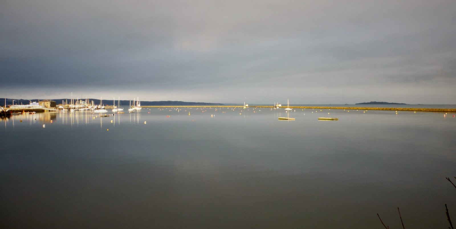
first sight of the coast, and a colour other than white
looking back at Lammer Law
I was regretting the car wasn't parked at Blinkbonny Woods, where Mary and I used to set off from. The owners have put up signs discouraging parking there, so we now park over at Hopes and start / finish there. But to make up the 30miles we had to run back to Gifford. It was another couple of miles, mostly downhill, but all the same I was glad to finish. We got there just before 4pm having set off just before 10. We "ran" for 5hrs30 having stopped in Carfraemill for 30mins. While it might have made for better photos doing this run in pleasant weather I felt we had perhaps achieved more doing it under adverse conditions, and got the feeling Graham H our TB founder and spiritual leader, would approve. And perhaps Tony too.
Gifford
31miles plus 2 via the station