
I saw Nick and Graham N had run the Berwick coastal paths and thought I'd give that a shot for June's Tynecastle Bronze run. The forecast was great for Monday and I didn't have a job on. Nick warned of hills after St Abbs and said a map would be handy around Dowlaw. I printed out 4 x A4 OS maps and caught the 9.30 train out of Waverley. I had a vague notion I should have bought advance tickets but was unsure if I'd make the 9.30am and thought, well buying tickets in Waverley can't be that much more than the £5 or £9 single to Berwick-upon-Tweed. It's still in advance of getting on the train? WRONG! Twenty three fucking pounds single. That's nearly a pound a minute. Note to self: even if I had bought a ticket for the 9.30 AND the 10.30 it still wouldn't have cost £23. I was still smarting from that when I got off in Berwick.

time and money whizzing by!

In a way I didn't really need a map as it was all just follow the coast.
(Or was it?)
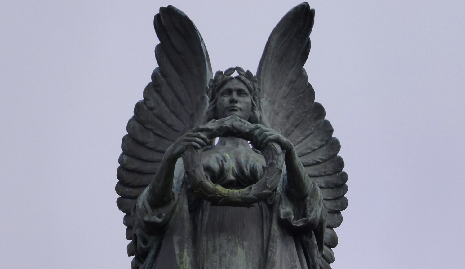
This attractive war memorial just yards from the station took care of TB business.

A short run across town takes you to the coastal paths.

First thing I noticed getting off the train was it was cold. Probably just as well as I had forgotten the sun cream. The day brightened later on but it stayed cloudy till well after Eyemouth. First few miles were a bit drab on lumpy (but well mown) grass trails.


I saw the rambler (on horizon in above image with his big orange backpack) from the train, a few miles out of Berwick. He was old school: big hefty walking boots and carrying a lot on his back. I reckoned I'd catch him fairly quickly. We were both approaching another static caravan site and he came back towards me having gone slightly wrong. I slowed to chat and we exchanged notes on the Herring Rd vs Southern Upland Way. He was doing 18 miles to Coldingham. He didn't ask where I was heading and I didn't tell him I was doing twice that to Dunbar.


Welcome to Scotland - please close the gate!
I put the Scotland sign photo in not because I came over all flag wavy but to show the size and amount of flies that were constant companions for a lot of the run. One of the black blips is a crow and it is the same size as the flies. They were not always welcome and I brushed them off my arms and legs regularly.


Other wildlife was more welcome and in considerable abundance. Lack of human traffic (I only met a handful of walkers and dog walkers) no doubt helped but I saw thousands of nesting seabirds, hundreds of butterflies and a few other odds and ends. Happily I got a decent pic of the main butterfly of the run, which meant I could run past the dozens that would take off from sunning themselves on the path, and not have to chase them down for a photo. The Painted Ladies were out in force and having googled them I am even more in awe of their story.

most likely a painted lady caterpillar
(approaching finger sized)

Painted Lady
(they start with vibrant colours and fade with age)(unsmiley sad face)
The Painted Lady can't overwinter in this country. That means come Winter they Fly or Die! Back to Europe and North Africa. Apparently you can watch clouds of them flying in over the English Channel from Europe and North Africa. And what are they? A couple of bits of coloured tissue paper with a small hairy tube of goo between. And they fly across 20 miles of open water. They can't land on the water like seabirds for a breather. Can they see land? Do they waggle their antennae and say right chaps this way, I'm off to Scotland for some thistles. They like thistles and nettles. Because they are HARD. They can breed here and maybe it is third generation models that make it this far North before the weather gets colder and triggers the turn around and they consider the options: fly or die! Do they have powers of consideration? They certainly seem to know when a runner approaches and can fly circles around him before he even gets his camera out.

Wall Brown
Unlike the bold and thriving Painted Lady, the Wall Brown is declining in numbers. I also saw a Small Copper (smiley winky face) but it was too quick for a photo.

Just before the Smugglers Bothy someone has been out placing signs. The first one declaring Yellow Meadow Ants didn't really grab me, though now I know. And I ran along the main path until "Badgers" appeared on the rise to the right. Who wouldn't take a diversion to meet the badgers? I ran over the hill and saw a number of things that were of value, but none of which were badgers. I do like the idea of putting overly ambitious signage out though. Which could be taken a step further under the mendacious gauze of the art world. Outdoor signs saying Northern Lights and pointing to the sky. Centaurs and griffins this way. The end of the world is nigh (on the left). Once when parked at a layby somewhere in the highlands we saw a sign saying beautiful waterfall or somesuch a bit along this track. We reckoned on reflection that it had been commissioned or constructed by the midges and that as soon as they got you far enough from your car, you were dead meat.

And I was unable to resist the sign saying "Peregrine Falcons, Bothy and Beach." Well, 2 out of 3 ain't bad. The bothy (remains in pic above) is the Smugglers Bothy established by John Robertson in 1760 but I haven't yet read all of the rest of the sign text so you'll have to google it. At the bottom it says "there are many traces of smuggling and other activities on the shore and it is worth the effort going to see them." Hmm a healthy dose of opinion over fact. Tell that to the falcons. I turned around pretty sharpish when I could see I was going to have to descend and then climb back up. I still had 30 miles to run. You know that thing when you end a marathon and say to yourself, "heck I don't feel tired yet I think I'll run another 10 miles"? Me neither. But due to a lack of train stations that was the deal. So no falcon-smuggling.

Since the path seemed obvious and well marked I hadn't been paying much attention to where I was on the maps I was carrying. When I looked down to the shoreline and saw these houses (above) I was surprised and couldn't find them on the map. This is all schoolboy error stuff - I should have been keeping track of where I was so that as soon as I was presented with a choice - unmarked field or road under trainline - I might have had some input to the decision.

Actually it might not have helped that much. The line I probably should have taken was down to the shore rather than duck under the railway. I saw no obvious pointers or paths and so continued through the field until it became narrow and I was trapped by the railwayline on one side and a steep embankment on the other. (See photo below looking back towards the long narrow field.)
I climbed the wall and looked for a descent through the scrub but it was impossible without shredding my legs on the nasty mix of brambles, thistles and nettles. It was quite steep too but it was the biters, scratchers and stingers that persuaded me back into the field and back following the coastal perimeter of the field looking for an easier line. Couldn't see one so eventually (40 minutes poorly spent) ran inland and under the rail tunnel onto the main road into what I now realised was Burnmouth. (Fingers burned at Burnmouth.) If only I'd taken that option in the first place. However the view of Burnmouth from the field above had let me know that the road below the cliffs on the North West of the estuary fizzled out and what I was looking for was the cliff top path not the shoreline.
So I knew to stay high as I ran through on the village outskirts, and sure enough at the Village Hall there was a marker saying cliff top walk to Eyemouth. Result, back on track.

long narrow field trapped between rail-line and scrambly brambly

Burnmouth

The route now seemed to get more photogenic, or maybe it was just the sun coming through and the relief of being back on decent paths. I had a quick chat with a dude who was taking photos of the meadow pipits on the rape. We agreed another week would have the place looking spectacular. He asked where I was heading, and feeling more positive I told him Dunbar. I could see a look of are-you-sure? cross his face and we had a laugh at the t-shirt he was wearing which had the motto "in dog years, I'm dead."


heading into Eyemouth
I wondered if there was an ENT dept at Eyemouth?
Eyemouth Ear Nose and Throat.


You can see Eyemouth some way off. The approach is round the golf course although I was nearly tempted by a more direct line. However the golf course path descended at a pleasant gradient and went round some interesting shoreline rock formations. I took photos of anything of note mainly for Mr. Limmer who enjoys a bit of geology. I could see a straighter line across to the harbour and got lucky leaving the corrugated tracks at the right point for a road into town. I sat on the wrong side of the harbour eating a sandwich and failing to take photos of the swallows zipping past before going for a pint at the Contented Sole (following Nick and Graham's lead) then buying more food and drink near the second wm of the day, and heading out the back onto more pretty coastal singletrack.


The sun was breaking through even more and things were going well. I felt a bit bloated from the pint and lunchtime sandwiches and sweets but knew I had to eat lots to fuel the journey. Coldingham Bay and the beach before were particularly scenic although the rugged coastline meant the paths traversed inland before swooping down to the coast on narrow descents with a few duckboards and pontoon bridges.


It was tempting to take the direct line but safer to follow paths that skirted inland to cross gullies and rivers.

Saw several of these themed small plaques stuck on larger items.

Lots of interesting rock formations but fewer pretty beaches than East Lothian.


continual climbing and descending made it quite tough

Coldingham Bay

Loved the beach huts and landscaped garden but the water looked very Coldingham.

On the way out of the Bay I spoke to a guy clearing the sand and weeds from the steps. He said I looked like I meant business and how far was I going. I said Dunbar and I got another one of those looks.

I hadn't expected St Abbs to appear right round the corner. Again it is very manicured with everything neatly maintained. I'm sure I could have spent an afternoon here exploring but was straight through and climbing the cliff top trails in no time, enjoying the views back to the harbour and a small boat, the Schiehallion, out of Leith, setting out lobster pots.


And then all of a sudden the landscape changes from cliffs to undulating paths up and down over the peninsula of St Abb's Head and the lighthouse. I was concerned it would be an out and back I might want to avoid, but asking other sightseers I was reassured the path after the lighthouse goes round the headland then descends to continue along the coast. I took a more direct line to get the view from higher ground then descended to the road. The sky was blue and the sun blasting. I hoped I had enough fluids to keep me going as there probably wasn't going to be any refills till Pease Bay.


penguins?


what lies ahead
Note the 2 poles that mark the measured mile.
Note the 2 poles that mark the measured mile.

Nick had said it was hard going on the next section, although I hadn't realised quite how much. I was glad I didn't have Graham setting a fast pace up ahead although I would have enjoyed some company. Not so keen on the marked path through a field of cattle (below) although they paid me no attention. I would have been asking for my money back if they had trampled me to death. Each of the hilly lumps is followed by a descent, often inland to chase a river or gorge until it can be crossed, when you are then presented with another leg trashing ascent, and then another hill down. The previous coastal runs on the Northumberland and Fife Coastal trails were - as you might imagine from coastal runs - much flatter.


A long time ago in a galaxy far far away, Mary and I and a friend Phil came climbing on rocks just up the coast at Fastcastle. It was a sweaty palmed, dry mouthed day of near death experiences and type 2 or 3 fun, and made me very glad I was only taking photos of the sea stacks today and staying well away from any heartpounding climbs.

Four markers are set out on the hill tops so that ships can note their speed and distance over time. One is set back from this one, so that from out at sea, you can triangulate when the mile starts and then when it stops. I forgot to time myself but it would have been one of my slowest miles given the arduous nature of the hills. Just checked and mile 18 on the garmin output was 15 minutes. Not bad considering!


a mile later

Next challenge was Dowlaw. Nick had given me the heads up to follow the map here and so I was paying attention. The route goes inland to skirt a stream or gully and knowing it was likely to be tricky I was careful and it was okay. I even improved on the route by taking a more direct line from the point inland to the road end and the cottages there instead of heading back to the coast and then reclimbing the ascent back onto the cliff tops. I was concerned about timing as I knew the trains were approx every 2hrs from Dunbar and that although I wasn't going to make the 5.45pm I didn't want to miss the 7.49pm.

This was one of the last signs I was definitely on route.
From this point you can almost see the finish line. The first glimpse of Torness and the Cement Factory on the far horizon mark the outskirts of Dunbar. I found this reassuring rather than OMG it's still flippin' MILES! But the path deteriorates again. And I was never 100% sure I was on the path. If there is a coastal path here it must be close to where I was but there were a number of sheep trods between the high ground inland and the drop off to the shore. You would surely see a decent path. At various points I scanned the alternatives and reckoned I had to be on the best option, but a lot of it still felt shit and was slow going. Shortly after the photo below I had to cross another gully and found myself wading through waist deep fern-and-bluebells to dip down to footsoaking stream where I washed my hands and neck in beautifully cold water before climbing up a steep sided bank of ferns-and-nettles with no handholds to reach a blessed gate and flat field of sheep. At the height of ferny deliverance a deer had leapt clear and bounded 2 steps over the horizon leaving me plodding sweatstained and confused through the swamp.


well the path is not down there


At last after a lot of bushwacking and climbing fences I returned to civilisation. There were some farm cottages down towards the sea but I chose to head towards this farm and the promise of a tarmac-ed road out of hell. It was such a relief to be running again that I put a 7.11 minute mile on the Garmin for mile 28, followed by a 7.46 and a 7.28. My plan was now to head to Dunbar by the easiest line and fuck the coastal jungle. However I then saw a sign pointing back to the coast and this goat (below) which Nick had taken a photo of. I was drawn to finish the route properly but then instantly put off as the arrows pointed through a field of aggressive looking cattle. Again, fuck that. I was running out of fluids, I was baked and beaten and had toxic tampon shock from acres of nettle rash, I was caked in sweat and rolled in dust, weary and losing the will to take photos. I dropped down through some rough field seeing another blessed road below and followed it west until it descended in a beautiful snaking curve to that natural haven Pease Bay which humans have desecrated with caravans, filling it like turds in a bucket.


On the upside, where there are holiday makers, there are bars, selling pints of cold lager. The other glass was full of cold cold water and I poured most of it into my reservoir. I glugged the Tennents in under a minute and set off rapido as I was still concerned about missing the 7.49. I had no real idea of how far still to go but sometimes it's not distance but conditions that call the shots, so rather than count miles on maps I just ran as promptly as I could and tried to take the most efficient route. On the way out of Pease Bay I spoke to guy who confirmed directions along the roads to Dunbar: the sustrans 76 route running parallel to the A1 before it crosses the road near Torness and runs past the concrete factory. Much of this we had run with Nick on the out and back to Cove. I was sorry not to visit Cove again (or see the stacks at Fast Castle Head I had nearly died on with Phil) but there was a train to be caught.


heaven and hell

slowly the Concrete Factory got closer
I had forgotten what distance it was from the factory to Dunbar and was so glassy eyed from sunstroke it could have said anything and I'd accept it and run on. The pace had dropped from 7 and a halfs to 8 and a halfs and worse but I got a real lift when a couple of corners after the factory it said Dunbar 2 miles. Hurray! I plodded in to Dunbar recognising the start of the Doon Hill course back to front and enjoying the fact I'd have long enough to lock myself in the spacious station toilet and change into dry clothes for the 25 minute train ride back to Edinburgh.
I was so pooped I only drank half the bottle of beer I bought on the hobble home from the station. I checked on a colour chart and my forehead was Farrow and Ball, Red Earth. I felt too frazzled to eat a proper dinner and went to bed after showering and looking through the day's photos. A good one but a tough one.


Yes, it's another wm, no I'm not stopping.
I look far fresher than I felt / smelt.
I look far fresher than I felt / smelt.

35.6 miles plus 2 (to and from Waverley)
note elevation considering I was never a mile from the sea
note elevation considering I was never a mile from the sea
elapsed time 9hrs, moving time 6hrs
though I was going so slowly on some of the hills the auto pause kicked in
No comments:
Post a Comment