
24th Nov
Coach Alan had asked me for input about routes for another group run for his coachees. (You'll remember the last one was in the Lomond Hills). A good project to get my teeth into. I was thinking a chopped down version of the NB Circuit. Could start and finish in East Linton, because everyone (except me) drives a car. Soon there's to be a train station there - opening this month I believe, (December) although not every train will stop there. But makes East Linton really viable for runs to Haddington up the Tyne, or Dunbar, or a circuit like this one I came up with.
There was one thing I really needed to check; the bridge. Seeing some nice weather on a Friday (Mary day off) I enquired if she fancied an explore (walk) round East Lothian. She did, as long as there weren't cattle fields to cross. I was fairly sure there wasn't. But kept any doubts to myself.

mistle thrush on way to car

first up: bought lunch sandwiches in coop
incl. fabulous Portuguese custard tart
incl. fabulous Portuguese custard tart

we headed up the JMW towards North Berwick
then turned East, (right,) at Stink Farm

we went clockwise heading North from East Linton

It was Baltic heading into the teeth of a cold breeze and I wondered should I have worn more. The climb up the hill out of E Linton generally sorted that and I warmed up quickly, but it was a warning that we were well into wintry conditions and to wear plenty outdoors, when not running. The sight of some farm labourers packing cauliflowers or cabbages onto a tractor conveyer belt in the middle of a field made me feel hugely grateful I was not working alongside them. Backbreaking, monotonous and pretty cold I'd imagine. (Enough to put you off that vegetable for life?) I also suspected that most of them were East European although I had no idea if that was the case.


Stink Farm
I was almost disappointed that "Stink Farm" was not brewing up whatever fertiliser horrors earned its nickname. It was such a poisonous evil brew it made you laugh out loud at how ferocious it was. None today. Nor any deer at the usual spot down the line of sight between containers.

A new path since I was last here. Or maybe we never saw it as we'd come down the trail from NB and turn left between the tractor accessories stacked down the parallel trail. This dirt trail has a much more official feel, like you aren't actually trespassing, which is good news! A pair of yellowhammers and some linnets or maybe twite flew about the trees. I nearly got some photos.

yellowhammer

The path took a couple of turns before heading towards Newbyth House. I think it runs assertiveness conferences and luxury spa breaks rather than solely housing knobs (although the two aren't mutually exclusive.) I have no idea where such insights came from.
Fact check!....Okay so I just googled and am completely wrong: it was developed in 1973 into 7 flats!
I wonder if they all get along? A good starting point for a murder mystery whodunnit surely? - Miles from nowhere 7 households living shoulder to shoulder in an ancient Mansionhouse, complete with ghosts, nouveau riche, a fading celebrity, aging lush, ambitious young couple (online influencers) and Colonel Mustard. The Postman Always Barks Twice sort of thing. Lights! Camera! Action!


I got all the way to Binning Wood without stopping for pics in Newbyth Wood which is a lovely place, just not much scenery in sunlight as we passed through. Binning Wood started overcast but brightened as we made a rough diagonal from aprox SW to NE. There are many trails so I was very pleased with myself managing to navigate a vaguely straight line on more interesting paths than just the main tourist ones. My dad is buried there and although we didn't go past his burial plot area, M and I both said mental howdedoodies (and maybe some out loud ones as well) and I'm pretty sure he did similar. For a while the paths were troubled with fallen trees from storms but I'm happy to report the logs have been chopped to allow traffic through again without too many diversions. It was really pleasant in the dappled light although the camera doesn't always catch the ambience.


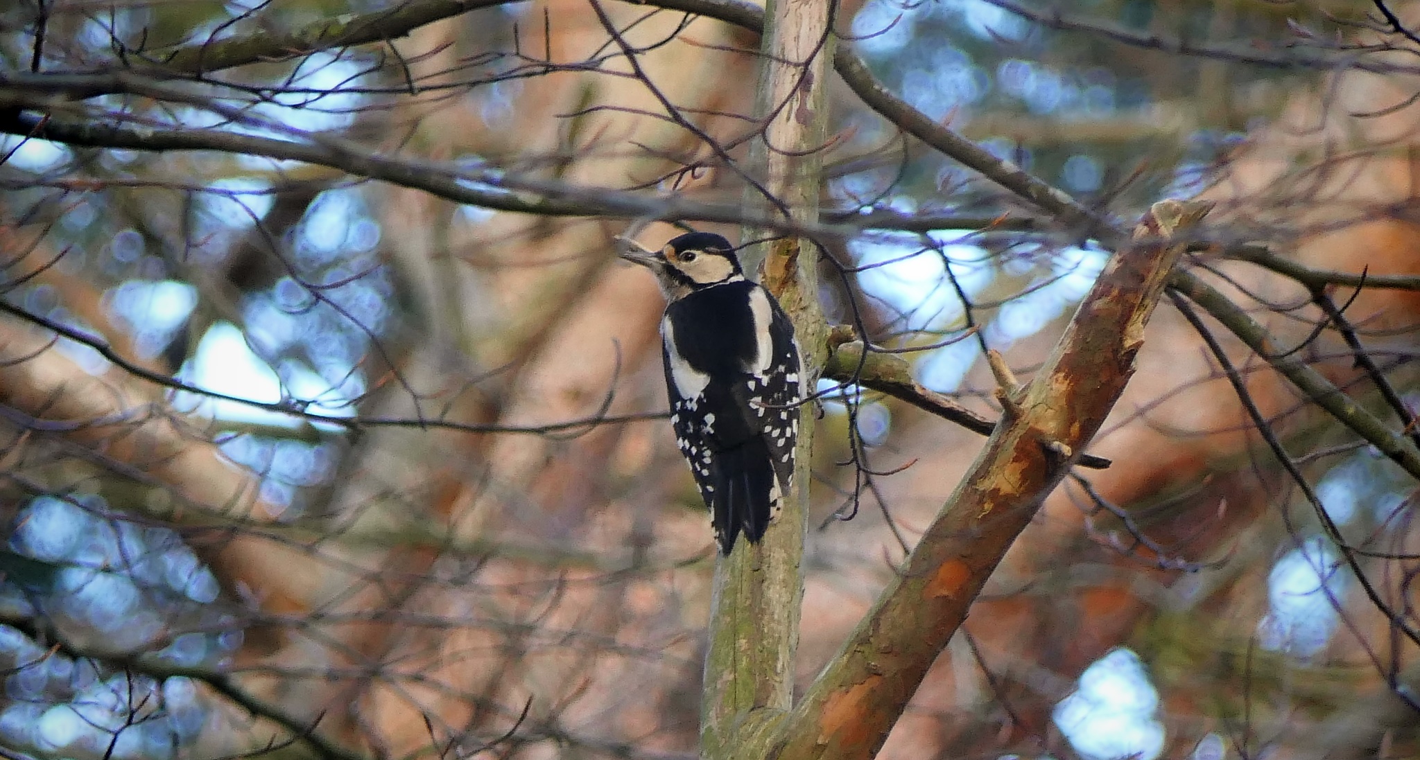
woodpecker
(had a real knack for hiding behind branches and foiling photographers)
(had a real knack for hiding behind branches and foiling photographers)


tall trees!
I saw some photos of Binning Wood a short while back looking outstanding in the sunlight with orange leaves all over the ground and still some in the trees. I think we were just too late to get this and most of the leaves were now on the ground. Great place for a wander.

across the road and straight on into more woods


I took photos of every unlikely turn and junction thinking Alan might well be bringing his team this way. The route is far from instinctive and there are some turn-offs like this one that leaves the main path to go up a muddy trail that runs parallel to the main trail but is more interesting.

It eventually ends at the log cabin also known as the Laucht cabin because Richard got married there. The view to the Bass Rock up Tyninghame beach is one of the best in the Lothians, although today the sun defied the forecast and stayed behind clouds quite a large amount of the time. It was catching the distant gannet island but not the beach or the cabin and the high tide hid most of the beach making the place look as drab as I've ever seen it!


oyster catchers feeling the stiff breeze

Our way along the beach might have got feet wet - not a pleasant prospect on a chilly day out - so we stayed on the grassy path along the tops of the dunes. When the sun came out it was a blow-away-the-cobwebs day. When the sun was absent it was just cold.


We stopped for lunch just round the prominence that is Baldred's Cradle. There was some wind shade and we were ready for something to eat. While Mary sat on a log I crept up towards some waders also taking advantage of the wind shade on this side of the land. As I approached them the sun came out which instantly improved the photos. Comparing with and without sun you'll see why I make such a deal about taking photos in decent light.

no direct sun

ahh that's better!


and a curlew too

Lunch was really good! However it was not sitting-about-weather and I worried that
A/ we still had a long way to go before nightfall and
B/ I wasn't absolutely sure of the route as I hadn't been this way in AGES! I was pretty sure I'd be able to get to where we were going (I had a rough route in my Suunto) I just hoped I didn't make any daft nav choices or go through any cattle fields.


I actually took a pretty much perfect line. I wanted to follow the coast but not too closely as it would be soaking from all the rain. Going inland was a little risky as we had to get through woods heading on instinctive bearings, but when I saw the rise into the pine trees in the photo above I knew where we were.

back on solid ground so to speak

We now had to follow the river's edge upstream through farmer's fields to the bridge and the crux of the route. I knew the bridge had a gate in the centre which could be locked or open. A few years ago it was open. If locked we were stuffed. We got nice views of Tyninghame House and Mary was very cool about going through fields of sheep on paths that weren't really tourists' paths so much as poachers' paths. We kept close to the waist high fence so it could be climbed if bulls appeared and charged.


the all important bridge

this is the big moment; open or locked?
(looks pretty wonky, eh?)
(looks pretty wonky, eh?)

I shuffled out very carefully to the centre of the bridge. It felt wobbly. And much more frail than last time I was here when maybe a dozen folk filed over. This was defo one-at-a-time frail. Rotten timbers and swaying thin metal. Tippy-toe out to the centre where Mary had already seen the large chain holding the gate closed. A giant combination padlock linked the chain. I looked at the five dials each with 9 digits. 2 were at seven. I tried all the sevens. Then all the threes and maybe 54321. And then tip-toed back to the side by Mary. Looks like the bridge is a no-goer then. While it would be possible to climb over or round the gate (if you were being chased by armed bandits) it would clearly not be suitable for Alan's group. Also it looked too frail to climb. Also I felt too frail to climb. If you went round the side, you'd be leaning out holding onto ancient rusty teaspoon-thick metal. It was a death trap and I was not unhappy to walk away quickly. I had no doubt the reason it was locked was to save people the bother of killing themselves on it.

This however royally fucked my route. I spent the next 10mins complaining. The planned circuit was to join up to the (Dunbar to East Linton) John Muir Way which was on the other side of the river. Now our only way to get there was through more not-very-legit fields and along a road without pavements that has very brisk traffic that tries to kill you and is deeply unpleasant, compared to the JMW. We were stuffed. Or the route was. I think the relief of me not insisting Mary cross the bridgey death-trap put Mary in a better mood and she was actually fine about the cattle-maybe fields and subsequent pavementless road. She didn't complain once. Maybe I complained enough for both of us. I couldn't see another alternative route to get back to the JMW riverside trails and my plans of impressing Alan and his group were binned right there. To paraphrase the A Team, I hate it when a plan goes to shit.

We left the Tyninghame Estate by following a signed path that said Walkers This Way. It turned out to be a very pleasant meander that added about a third of a mile to what might have been a straightforward 200 yards of tarmac. The road we might have taken is marked on the map with blue dots. We did the scenic meander through the woods. It was nice if a bit timewasting!

pavementless road - not nice

We did about half a mile of fast traffic pavementless road before getting to the large bridge across the Tyne. This is the first bridge heading upstream from the estuary if you can't cross the iron and string shitheap with the padlock. You could probably do it (the death road) on the inside of the field if you had shears to make an escape through the thick hedge. We just jumped up on the verge when cars flew by. But it did not fill us with joy. The JMW by comparison was a delight - heading into the setting sun along the riverside paths. What a shame the closed bridge ruined such a lovely circuit. In decent weather these are some of the best trails in East Lothian and a delight to run. We both felt pretty tired after being out about 5hrs and at least one of us wasn't being that determined about checking for kingfishers. It was nice to have the traumas behind us and back on decent quiet paths back to the car.

in the distance the spire of East Linton church


mostly a good day out

the setting sun picks out the filth on our windscreen - classy!


13.1 miles, 5hrs walking
Had we crossed the bridge (marked with an X) we would have followed the fuschia dots round to the next bridge (the one we actually crossed). That way we'd miss the big fast road and most of the trespassing through Tyninghame Estate. I suppose a return up Limetree Walk and a variation through Binning Wood would be possible but not as pleasingly circuit-y as the original plan. I am sorry Alan, I gave it a good shot but I suggest my other route of 10 Pentland miles might be less hassle. 😕
No comments:
Post a Comment